
A 14.5-mile crushed-stone rail trail from a restored depot to the Chippewa River, with the trailheads, the park, the pizza and the passes.
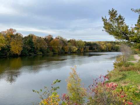
A path of crushed stone leaves a restored railroad depot in Menomonie, follows the Red Cedar River south past sandstone cliffs and ends 14.5 miles later where it joins the Chippewa River State Trail. That is the Red Cedar State Trail, and a red cedar trail Menomonie ride starts at the depot on Brickyard Road, beside a park and a brewery. The corridor was a Milwaukee Road line that stopped running in 1973, and the state opened the trail in 1982.
This guide follows the trail from the depot to the Irvington trailhead and then south, and it says where the places to eat sit at the start of the ride. It leaves out the Downsville end beyond a few facts, because the walk-up details there come from sources that are not dated.
Sponsored
The depot at the head of the trail
One reviewer admired how well the depot has been preserved, and another warned that the Junction Trail, which people often confuse with this one, lies to the north. A reviewer who arrived during the COVID-19 closures found the building shut and picnicked in the park beside it instead.
The Wisconsin DNR says the depot sells trail passes and has parking, and it lists a state trail pass as required for bicycling and cross-country skiing. An undated Menomonie community wiki page puts the summer hours at 10 a.m. to 4 p.m. daily from May to October, staffed by volunteers from the Friends group and DNR staff on weekends, so check before relying on the building being open. A Wisconsin bike-trail site, also undated, lists a bike rack, a tire pump and a self-registration station at the trailhead.
The DNR page also warned of Highway 29 construction from August 26, 2026 that would close the depot parking lot while the visitor center stayed open, with the city trail lot and the Riverside Park lot named as alternatives. That notice ran to fall 2026, so confirm the lot is open again before you drive in.
Riverside Park and the brewery at the trailhead
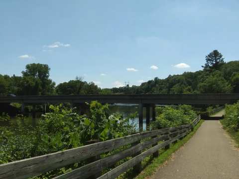
A reviewer who walked the gravel path under shade said it was lined with trees and busy with bikes, while another found a fallen tree across the path that blocked a wheelchair user until walkers snapped the branches aside. That is one undated account, but it is a fair warning that the path is a natural surface and may need clearing after a storm.
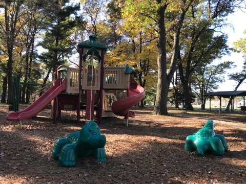
Riverside Park is the trail's front yard, and Wilson Park downtown and Wakanda Park on the lake belong to the wider set of Menomonie parks.
Irvington and the stretch south
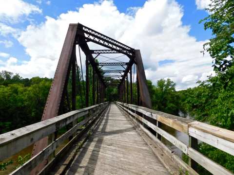
The same bike-trail site describes the trail as level and tracking the river, with sandstone cliffs beside it and a small natural area called Devil's Punchbowl, with a waterfall, about 2 miles south of Menomonie. Wikipedia counts eleven converted railroad bridges on the trail, two of them trestles. An information kiosk series describes local quarry history.
The Wisconsin bike-trail site puts the distance from the Menomonie trailhead to Downsville at 7.9 miles, where a roughly 200-foot truss bridge built in 1882 crosses the river. The Downsville trailhead sits at Highway 25 and County Highway C, and the DNR says the Empire in Pine Lumber Museum nearby covers the lumber era of Dunn County.
The trail's own history goes back to the lumber era, since an undated community wiki says Knapp, Stout & Co. ran a line there in the late 1800s that carried freight and lumber. The Red Cedar line later became a railroad corridor that the DNR took over to preserve it for the public.
Where the trail meets the Chippewa River
The southern end joins the Chippewa River State Trail in the Dunnville Wildlife Area, near the meeting of the Red Cedar and Chippewa rivers, where the DNR says sandbars offer swimming, fishing and picnicking. A Wisconsin bike-trail site says the parking lot there has no other facilities, and Wikipedia says the Chippewa River State Trail runs 26 miles between Eau Claire and Durand on crushed limestone. As of 2022, Wikipedia adds, the two trails connect Menomonie and Eau Claire.
A 2020 Volume One article described a 76-mile system of the Red Cedar, Old Abe and Chippewa River trails linking Menomonie, Durand, Eau Claire, Lake Hallie, Chippewa Falls and Cornell. Treat the full distance as a long day, because the Red Cedar leg alone is 14.5 miles each way.
The DNR trail page also posted a culvert replacement south of Menomonie that closed 1.5 miles between markers 1.5 and 3, with a town road detour, from September 28 into October 2026. It also listed tentative resurfacing of a 12-mile section of the Chippewa River trail from its junction with the Red Cedar trail, so check the DNR page before a long ride.
Before and after the ride
The story behind the Paul Bunyan namesake is told in the Lucette Brewing story.
Acoustic Cafe is one of the Menomonie coffee shops on Main Street West, and Raw Deal, on South Broadway, is about 0.06 miles from it.
Passes, seasons and what the trail is like in winter
The DNR says the trail is open year-round and that a state trail pass is required for bicycling and cross-country skiing. Passes are sold at the depot and in the Friends group's online store. This guide gives no pass prices, because the DNR page did not state any and older figures could be out of date.
In snow the trail is groomed for cross-country skiing. The Friends site links to ski condition reports on the SkinnySki website for the trail. Past event listings describe a free candlelight ski, hike and snowshoe night at the depot with snowshoes provided and hot chocolate, though those listings are from 2022 and 2025, so confirm any new date.
Visit Eau Claire says the trail has few highway crossings, which it presents as a safety advantage, and picnic areas and benches along the route. Volume One's trail listing describes bluffs, a trestle crossing and frequent bald eagle sightings.
How to choose your ride
Pick the depot and Riverside Park for a short walk, a picnic or a ride with children, since the restrooms and picnic shelters sit within 0.15 miles of each other. Pick Irvington for a quieter start with river access, and plan the Chippewa River junction only if you can spare a day.
If the ride is one part of a longer trip, a long weekend in Menomonie is the place to see what else fits around it. Whichever stretch you ride, the path still runs from a depot to a river.
What this guide cannot tell you
It gives no pass prices, current depot hours, bike rental details or trail conditions after the autumn 2026 work, because no source checked carried a current one. Several trail details come from undated community pages, and the Downsville end was not walked or reviewed here.
Frequently asked questions
Published October 26, 2026