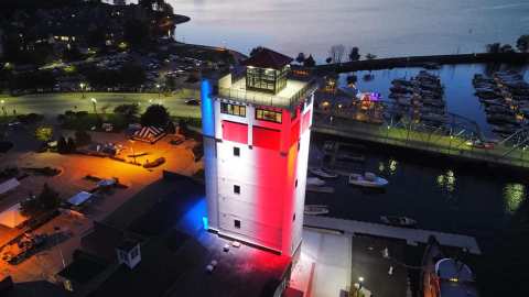
The red pierhead light, the skeletal rear tower, a working Coast Guard station and the museums that explain why a town dug through a peninsula.
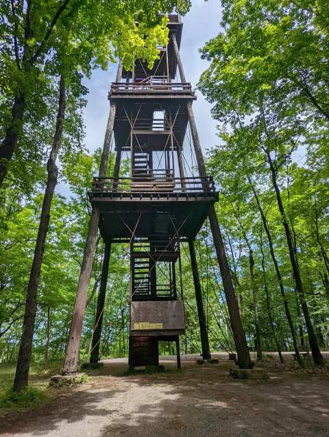
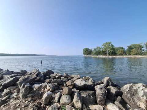
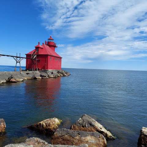
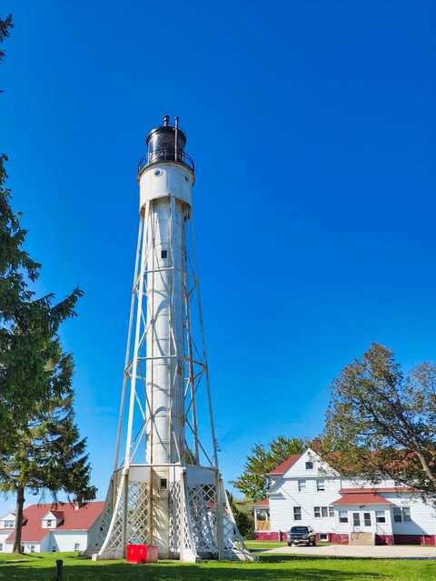
Stand at the lake end of the Sturgeon Bay ship canal and the whole reason for the place is in front of you: a narrow cut through a peninsula, a red pier running out into the water, and a skeletal steel tower rising behind you. Freighters and tugs still use that cut to get between Green Bay and Lake Michigan without rounding the tip of the peninsula. It is a working waterway rather than a polished attraction.
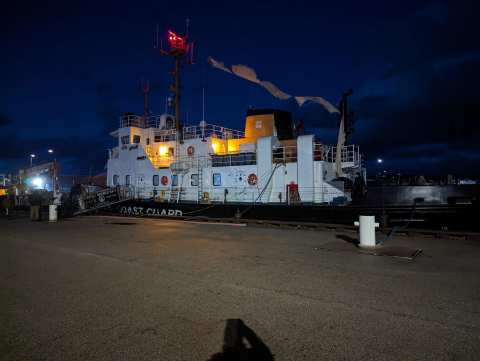
Two lighthouses mark its lake end with a Coast Guard station beside them, and a pair of museums in town explain how it all got here, which makes a good half day among the things to do in Sturgeon Bay. The lights sit about 4 miles in a straight line from the shops on 3rd Avenue, so this is a separate trip out from downtown, not a walk.
Sponsored
Why anyone dug a canal here
The reason was a stretch of water that sailors feared. Before the canal, ships between Green Bay and the southern lake ports had to go around the tip of the Door Peninsula and cross the strait known as Death's Door. A Historical Marker Database entry says the cut shortened the trip from Green Bay to Milwaukee or Chicago by more than 150 miles. Joseph Harris Sr., a newspaper editor who arrived in Sturgeon Bay in 1855, pushed for the idea for years, and the state granted a charter to the canal company in 1864.
Digging began on July 8, 1872, under a private group led by William Ogden, then president of the Chicago and North Western Railway. A depression stopped the work for three years, and it resumed in 1877. The original cut was 7,400 feet long, 100 feet wide and 6 feet deep, and the finished canal cost $291,461.69 by the end of 1881.
Ask when the canal opened and the sources give you a spread rather than one date. The Historical Marker Database says the last dirt barrier came out on June 28, 1878. Wikipedia and the American Canal Society record that smaller craft began using the canal in 1880 and that digging finished in late fall 1881. The Wisconsin 101 shipbuilding history uses 1881 as the opening year, while Lighthouse Friends says large vessels did not use it until 1882, the year the Marker Database counts 415 ships passing through. Most of the sources settle on 1881 for the finished canal, with 1878 to 1882 as the years around it.
The Army Corps of Engineers began work on the breakwater and harbor of refuge at the lake end in the late 1870s. In 1893, Congress paid $103,000 to buy the privately owned canal, and the Corps has maintained it since. Wikipedia lists the channel today as about 125 feet wide, and Wikipedia and the American Canal Society put the depth at about 20 to 30 feet. The cut itself runs about 1.3 miles through the peninsula, and there are no locks.
The two lights on the lake end
The canal's lights are the part of this story you can walk up to. The two lights are about 0.3 miles apart, so a single stop covers both. Free parking is just outside the gate of the active Coast Guard station, and the walk to the pier is on the station road.
That missing signage is the reason a little reading beforehand pays off. Lighthouse Friends reports that the pier is open while the tower and dwelling are closed, and Destination Door County describes the lower level as the way to get close to the red tower. A Destination Door County page suggests early morning and just before sunset, and it calls the east-facing spot a good one for sunrise. A reviewer describes sitting on the pier at sunrise and watching mergansers fish and nest on the rocks.
Lighthouse Friends gives directions from Highway 42 via Utah Street, Cove Road and Canal Drive, with 2.7 miles on Canal Drive to reach the Coast Guard station, so follow your own navigation and watch for the station gate. Destination Door County lists a Lighthouse Walk on the second weekend in June, when the grounds are open to the public, so check the current year's details before planning around it. The station itself is a real working one, and its building dates to 1886.
Where the canal's story is told in town
The place to start is the Door County Maritime Museum on North Madison Avenue, on the waterfront in downtown Sturgeon Bay and about 4.2 miles from the lights. Its galleries cover the area's working waterfront, from anglers and ship captains to craftsmen and lighthouse keepers.
The museum itself opened in 1969. A reviewer who remembered the older museum felt the lighthouses of Door County got thin treatment, so go for the boats and shipbuilding.
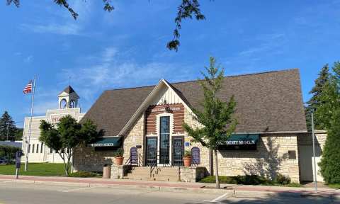
About half a mile away, the Door County Museum and Archives at 18 North 4th Avenue covers the wider county story rather than the canal alone. Its own descriptions list the Seasons of Life wildlife diorama, a firehouse with restored fire engines and a replica street scene. Admission is free, and reviewers on a rainy day call it bigger on the inside than it looks. Sources disagree on its opening days, so call 920-743-5809 before you go. Neither of its published descriptions mentions canal or shipbuilding displays.
To stand where the canal meets the town, the Sawyer Park waterfront is about 0.1 miles from the maritime museum. The Historical Marker Database records a canal marker in Sawyer Park, erected in 2014 and placed north of the Oregon Street Bridge.
A shipbuilding town because of the cut
Without the canal, Sturgeon Bay would have been a quiet lumber and limestone port. The Wisconsin 101 history says the canal made the town a protected, central hub for shipbuilding, and local shipbuilding grew from the 1890s. The Rieboldt and Wolter Company was established in 1896 and became the leading shipbuilder in the town. In January 1926, Universal Shipbuilding and Sturgeon Bay Dry Dock merged to form the Sturgeon Bay Shipbuilding and Drydock Company.
The yard launched 85 steel vessels between 1941 and 1943, a figure from the same history that includes dredge tenders, cargo ships and supply vessels. The company was sold into Bay Shipbuilding in 1968, and Wikipedia says the yards sat on the east side of the ship canal. Fincantieri Marine Group acquired the business from Manitowoc effective December 31, 2008. Highways 42 and 57 were rerouted onto the Bayview Bridge in 1978 to bypass downtown, which changed how traffic moves around the old downtown.
Practical limits worth knowing
The tower interiors are closed, the Coast Guard station is working and the fences mean what they say. A 2023 local report said the Corps planned a one-to-two-million-dollar repair of the breakwater at the canal entrance, with no dates given, so conditions on the pier may differ from what this guide describes. Look at the weather before you go, since reviewers connect the pier's slippery concrete to rough conditions, and wear shoes with grip. There is no informational signage on the pier, so the museums downtown are where the explanation lives.
A half day works well in this order. Start at the maritime museum when it opens, book the tug tour, then drive out to the lights in the afternoon with the whole story in your head. Stand on the pier at the end, watch whatever hull comes through, and the cut that Harris argued for makes sense from the water side.
The canal still does what it was dug to do, which is let a boat pass through a peninsula, and the best proof is standing on a slick concrete pier watching it happen.
Frequently asked questions
Published October 12, 2026