The tower, the Ice Age Trail terminus, Daisy Field campground and where to swim nearby.
Sturgeon Bay stops being a harbor town and turns into limestone bluff, hemlock shade and a long look across the water at Potawatomi State Park. A single tower, a trail that ends where the Ice Age Trail begins, and a rocky shore with no sand on it make up most of the story, and each of them rewards a visit that is planned a little.
The park sits on the bay about 2.0 miles north-west of the city's lakefront parks, so it works as a half-day trip from downtown or as the anchor of a longer stay. This guide covers what the park is, the tower, the trails, the campground, the water, and the nearby parks that fill the gaps. If you are still choosing among stops, the park pairs well with the museums, canal lights and waterfront walks across town.
Sponsored
What the park is
The ground has a longer past than most visitors guess. The federal government set aside about 1,000 acres here in 1837 as a reservation called Government Bluff, valued for its views and for the dolomite that could be quarried, and a federal quarry operation dated from 1834. The state legislature created the park in 1928 after buying 1,046.10 acres from the federal government.
Winter sport came later. A winter sports club developed the area in 1941, with downhill skiing, tobogganing and ski jumping, and a ski club ran the hill until it closed after the 1997 to 1998 season. The old ski hill overlook is still a landmark, and the DNR places the eastern end of the Ice Age Trail near it.
The park takes its name from the tribe that lived along the shores and islands of Green Bay. The DNR says the tribe called themselves Bo-De-Wad-Me, which means keeper of the fire.
The observation tower
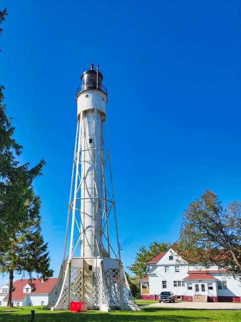
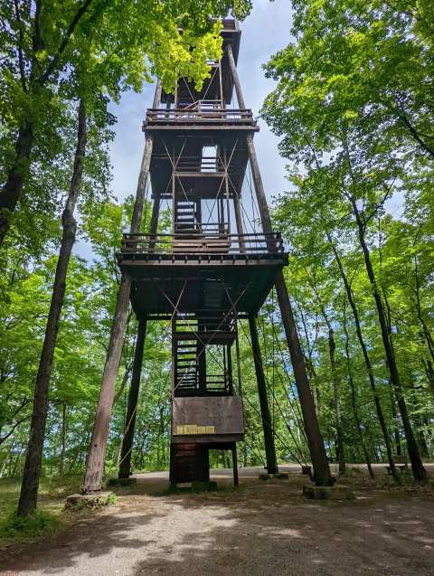
The tower is the reason many people come. It is a 75-foot structure built in 1931, financed by the Sawyer Commercial Club and listed on the Wisconsin and National Registers of Historic Places. A Destination Door County listing says the climb gives a view from 225 feet above bay level, and the same regional guide puts the climb at about 100 steps.
It was not always open. The DNR announced on March 10, 2025 that the tower had been closed since December 2017 because engineers found significant wood decay and unsafe conditions. An emergency stabilization project began the restoration, and the state planned to reopen it in mid to late April 2025, once snow and ice cleared.
Local advocates pushed for the repair. The Door County Daily News reports that in 2024 the state agreed to fix the structure after lobbying from the Sturgeon Bay Historical Society, legislators and a timber engineer. Some officials argued the tower should be accessible to everyone, as a newer tower elsewhere is, so the state created a scenic outlook for visitors who cannot climb. The historical society marked the reopening with a community climb and an evening talk at the Door County Granary on October 7, 2025.
Plan around the season. The regional guide says the tower is open roughly mid-April through late November, and that the road to its small parking lot closes in winter. It estimates the lot holds about 15 cars, so visit early or late on a busy weekend. Check the DNR conditions page before you drive up, because the DNR's own trail page still refers to an old observation tower and the details can change.
Trails and the Ice Age Trail
The DNR lists four named trails. The Ancient Shores Trail is 0.5 miles with signs about three ancient shorelines, and it starts near the Nature Center and park store. The Hemlock Trail is 2.6 miles from Parking Lot 2 in the picnic area, running along the shoreline, past the campground and through the interior. The Tower Trail is 3.6 miles and climbs to the highest bluff in the park, passing the campground on its loop.
The fourth trail is the one with a reputation. A 2.8-mile section of the Ice Age National Scenic Trail runs through the park, and the park marks its eastern terminus. The whole trail runs about 1,000 miles along the edge of the last continental glacier in Wisconsin. Joining the Ice Age and Tower trails makes a route of roughly 6 miles, which a regional guide calls moderate.
Be ready to navigate for yourself. One reviewer who hiked the tower trail called it an easy to moderate walk with several scenic overlooks of the water, but said they took a wrong turn a couple of times because trail markers were lacking and there were restrooms at the start and one more along the way. Another reviewer said they walked on a bike and ski path in the wrong direction. The regional guide advises picking up a free paper copy of the trail layout at the park office and notes weak cell reception inside the park.
Camping at Daisy Field
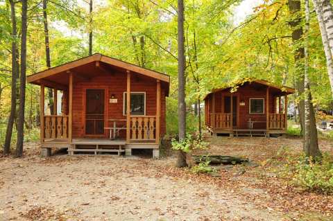
Daisy Field is the park's campground, and it has 123 sites across two loops, 40 of them with electricity. There are four group sites, each for up to 30 people, and an accessible cabin called Cabin by the Bay that sleeps up to six and has a wheel-in shower, heating and air conditioning. Two paved accessible sites with electric pedestals sit in the south loop. Reservations are made online, and a Destination Door County listing says they open up to 11 months ahead. Other campgrounds around Sturgeon Bay are an option if these sites are taken.
Visitors are generally happy. Reviewers call the campground clean, quiet and well maintained, mention the camp store for supplies, and describe sites that were deep enough to extend an awning, though one was a little narrow to enter. Firewood is sold at the park store, and the DNR asks you not to bring your own because of Wisconsin's firewood restrictions. Showers and flush toilets are seasonal, while vault toilets stay open year-round.
Winter camping is possible but should be confirmed. The regional guide says some south loop sites stay open for winter, while a Destination Door County listing tells winter campers to contact the park directly.
The water, and where to swim
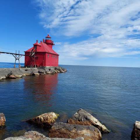
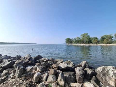
There is no swimming beach here. The regional guide describes a rocky dolomite shore, and Islands magazine, in an October 2026 piece, also says the park has no swimming beach. What the park does have is a boat launch on Sawyer Harbor and an accessible fishing pier. The regional guide adds that kayak, canoe, paddleboard and rowboat rentals run from Memorial Day through Labor Day, and that anglers 16 and older need a Wisconsin fishing license.
Where to sleep nearby
Passes, costs and honest limits
A vehicle admission sticker is required to enter. Its admission page lists rates effective August 19, 2025, of $28 for a 12-month sticker on Wisconsin plates and $50 on out-of-state plates, with daily passes at $13 and $16. Paying after you enter adds a $5 fee. A regional guide updated in October 2026 repeats the $28 and $50 figures. Campers need a pass too, and rates can change, so confirm on the DNR site.
There are limits to plan for. The park is small, and one reviewer noted that development is visible across the water, so it will not feel like a remote wilderness. The same reviewer warned about potholes and worn road surface in places. Facilities such as showers, the dump station and the park store are seasonal, and the tower road closes in winter.
Sources disagree on small details, such as the length of the tower loop, so use the DNR trail page and the park office for the final word. The park office number listed by one directory is 920-746-2890.
Take the tower in the morning, the Ice Age Trail in the middle of the day and a sunset on Third Avenue at the end, and the park stays what it was in the first place, the one corner of Sturgeon Bay where the bluff, the trail and the water meet.
Frequently asked questions
Published October 5, 2026