
1,845 acres of tamarack, sedge mat and six lakes west of Saukville: the Watts Lake trail, Mud Lake by canoe, plants, birds and the rules.
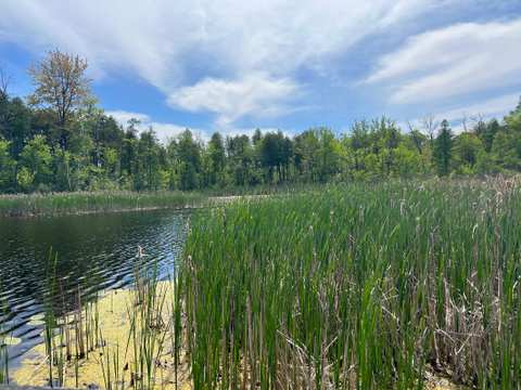
West of Saukville, south of Highway 33 and east of Newburg, the fields give way to tamarack, sedge and open water. This is the Cedarburg Bog State Natural Area: 1,845 acres of bog and lakes that the Wisconsin DNR calls the most intact large bog in southeastern Wisconsin. It was designated a State Natural Area in 1952, and it became a National Natural Landmark in 1973. It sits about 3.4 miles west of downtown Saukville, and it is the wild end of the things to do in Saukville: one short trail, a pier, and a lot of quiet.
What kind of place the Cedarburg Bog is
Sponsored
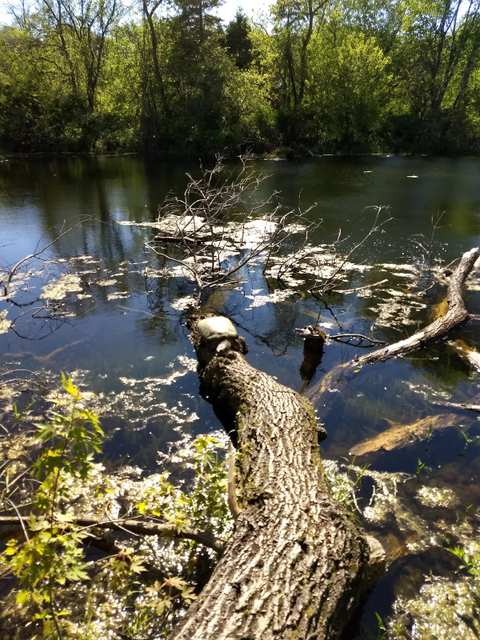
Many of the plants and animals here are more common in the boreal forests of the north. Strictly, much of it is a fen rather than a bog, because water flows through it, a point a 2016 Wisconsin Life piece made with Kate Redmond of the Friends of the Cedarburg Bog. Everything grows in the top foot of soft organic muck, and the trees hold each other up with interlocking roots, the same piece explains.
Walking the Watts Lake trail
The main trail on foot is the Watts Lake trail at the north end. From the corner of County Y and Highway 33 in Newburg, the DNR's directions run 2.6 miles east on Highway 33 to a parking area on the south side of the road, where a trail leads to a pier on Watts Lake. Coming from Saukville, the Wisconsin Society for Ornithology gives it as 4.4 miles west on Highway 33 from I-43 exit 96.
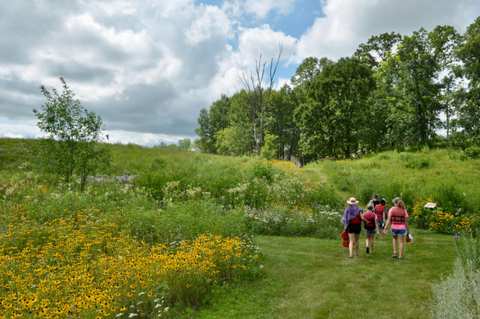
Our listing describes two easy trails from the lot, one to Watts Lake and one out to a meadow, with informational plaques along the path. Hiking Project maps the Meadow Loop as a 0.7-mile lollipop off the Watts Lake trail, with only 22 feet of climbing and boardwalks over the boggiest ground. The listing gives the hours as 6 a.m. to 9 p.m. daily, and notes there are no trash cans on site, so carry out what you bring in. The walk is short; the point is to stand on the pier and look.
Reaching Mud Lake and the interior by canoe
The heart of the bog is not reachable on foot: the DNR says a canoe or kayak is required to get into the interior. For Mud Lake, its directions run 4.2 miles south of Newburg on County Y, then 0.75 miles east on Cedar-Sauk Road, to a pull-off on the north side and an unimproved, boggy trail north. The ornithology society describes a portage of nearly 400 yards from the Cedar-Sauk parking area to the water. Carry a light boat, wear boots you do not mind soaking, and leave word of where you went.
Plants to look for
The DNR lists narrow-leaved sedges, pitcher plants, bogbeans, orchids, sundew and bladderwort on the sedge mat. Pitcher plants and sundews are adapted to the nutrient-poor ground, and the field station's plant list ran to about 370 species when Wisconsin Life visited in 2016. Redmond also warned that poison sumac grows on the hummocks, though not much along the trail, so look before you grab a branch. Collecting is prohibited: no plants, seeds, roots, fungi, rocks, soil or downed wood leave a State Natural Area, so bring a zoom lens rather than a trowel.
Birding the Cedarburg Bog
Birders come for northern species near the southern edge of their breeding range. The Wisconsin Society for Ornithology lists Alder Flycatcher, Winter Wren, Veery, Northern Waterthrush and Nashville and Mourning Warblers among them. Mud Lake is an early spring stopover for migrating swans, geese and ducks, and Marsh Wrens and Swamp Sparrows are abundant there, the same guide says. In winter, it suggests checking suitable habitat for Northern Saw-whet Owl. Redmond called the bog a dynamite place for dragonflies in that 2016 piece.
The society rates Blue Goose Road and St. Augustine Road, about two miles north of Highway 33, as the prime birding areas. Its list for the beech-maple woods on St. Augustine Road includes Pileated Woodpecker, Wood Thrush and Scarlet Tanager, and the UW-Milwaukee grasslands hold Eastern Bluebird and Henslow's Sparrow. Some land around the bog is private, including along County Highway I on the east side, so stay on public ground and roadsides.
Rules, hunting and winter access
On DNR-owned land, the agency allows hiking, fishing, cross-country skiing, hunting, trapping, pets and wildlife viewing. Hunting and trapping are not allowed on the university-owned land. Camping, campfires, geocaching, horseback riding, rock climbing and motorized vehicles outside designated areas are prohibited on every State Natural Area. In hunting season, keep that in mind: Redmond noted in 2016 that most hunters stay within about a hundred yards of the edges. The parking lots and lanes are generally not plowed in winter, so a snowy visit may mean parking elsewhere or waiting for a thaw.
Who looks after the bog
Ownership is shared between the University of Wisconsin Board of Regents and the Wisconsin DNR. The UW-Milwaukee Field Station, on Blue Goose Road, handles group access to the university land; the DNR lists its number as 262-675-6844. The Friends of the Cedarburg Bog, a partner group, has led guided walks to Watts Lake that meet at the Highway 33 lot. A guided walk is a good way to learn what you are looking at.
Pair it with Riveredge, Tendick and lunch in Saukville
With children, start at Riveredge and finish with a short walk out to the Watts Lake pier.
South toward Grafton, Pleasant Valley Nature Park is about 3 miles southeast and grooms its trails for snowshoeing and fat-tire biking in winter.
For lunch, the places to eat in Saukville are about 3.5 miles east: Cadiville builds smash burgers, and the games are on at Rally Time Sports Bar.
Heading the other way, Newburg Brewery in Newburg, about 3.3 miles northwest, serves pizza from Leroy's, its listing says.
Frequently asked questions
Published September 14, 2026